Outflows
Water leaves the lake year-round as it percolates into the Rathdrum Prairie Aquifer along the lake’s southwestern reach. According to the 2015 edition of the Spokane Valley Rathdrum Prairie Aquifer Atlas (1), 45 million gallons (mgd) or 138 acre-feet What is an Acre-Foot?
One football field (minus the end zones), is about one acre in size. A pond the size of a football field, filled to a depth of one foot, would hold one acre-foot of water.
Not comfortable with acre-feet? Check out an online converter(4) to change to any other volume units.leave the lake and seep into the aquifer every day! That’s more than Lake Pend Orielle’s 43 mgd and about half of Coeur d’Alene Lake’s 89 mgd.
The surface of Hayden Lake is 3,901 acres. Its average volume is 362,000 acre-feet. Enough water flows from the lake into the aquifer each day to cover 138 football fields in 1 foot of water. It sounds like a lot, but that’s only 0.034 % of the lake’s volume.

In the spring, when the lake elevation rises above the OHWM, lake water flows over the spillway at its southwestern tip into the neighboring field. This out-flow is wholly dependent on winter precipitation and spring weather. It runs from days to months each spring and stops by the time summer is in full swing.
In the hot, dry months of the year, water also leaves the lake by evaporation from its surface. In those same months, residents along the shore pump lake water for irrigation and personal residential use. History tells of several irrigation districts drawing water from the lake. Dalton Irrigation District is the only one that remains, drawing lake water when they cannot meet demand via other sources.
Today’s Outflow
In the late fall and early winter, the water level is so far below the spillway that you can’t imagine it reaching that height again. This is when outflows are minimal. Evaporation is low since the temperature is low, the air is humid, and the wind is inconsistent. The shoreline is still populated primarily by seasonal residents who have abandoned the North Idaho cold for the winter, and irrigation systems are offline for the season. Thus, the human draw from the lake is at its lowest for the year. The most significant outflow that remains is the transfer of water into the aquifer. We can speculate that even that has declined to some degree due to the low level of the lake. (The flowrate is affected by the weight of the water and by the area of the interface between the lake and the aquifer.)
Inflows
Water comes into Hayden Lake from streams that carry runoff from the surrounding watershed. Most notably, Hayden Creek and Mokins Creek run year-round (2). A study conducted by Eastern Washington University in 1985 determined that runoff from streams added roughly 8% to the lake’s average 362,000 acre-feet volume (3).
The lake also receives runoff directly from the slopes and springs adjacent to the lake, and rain and snow that fall on the lake. The average precipitation from 2008-2018 was 17.62 in/yr. This input added to the lake volume by about 1.84 acre-feet per year. This contribution is small in comparison to that of runoff from the watershed.
 Today’s Inflow
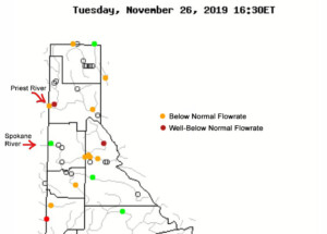
When rain falls in the watershed in the autumn, it will first soak into the soil that has been dry and thirsty throughout the rain-free summer season. Once the soil is saturated, precipitation will run off the land and into the local waterways. While, according to the Coeur d’Alene Press, we have had “normal” or above precipitation in the lowlands, the upper watershed appears to be dry. Current streamflows in the rivers outside the Hayden Lake Watershed but within our watershed’s weather system are below or severely below normal. We don’t have direct measurements of Hayden Creek and Mokins Creek flows, but we can assume that they are below normal as well.
A Balance of Inflow and Outflow
Hayden Lake’s elevation, at any point in time, marks the balance between inflow and outflow. Today, its inflows are negligible, not having recovered from the summer dry in spite of fall precipitation. Its outflows are reduced but continue, dominated by the ever-present link between the lake and the aquifer. Not surprisingly, these factors perpetuate the Annual Sinking of the Lake.


2 Responses
when the army corp of engineers decided to widen the dike back in the mid 90s because of a few houses built to close to the lake, as the story goes, that created a lot of problems for the lake as far as erosion of beaches and water level throughout the year. add to that the huge wakes these wakeboard boats make and all the damage to the shoreline that causes and you have a lake on its way out. climate change isn’t the reason for hayden lakes problems.
Great set of articles….my conversations with Dalton told me they don’t use alternate source of water for irrigation except Hayden Lake…I hope I am wrong…they told me the lake has never been low enough to stop pumping…North Kootenai Water District takes water from the lake year round for domestic water and irrigation about 70 homes as they say they cannot drill a well. the Hayden Lake Country Club takes most of its golf course irrigation from the lake, except for 3 holes across stahorn….all of this is completely unregulated as is the homeowners who draw water from the lake. The science of climate change has been proven as valid so its likely our snow pack and other water sources for the lake will gradually lessen or be more variable in years to come…I hope the Hayden Lake Water District continues their great work and monitoring and thinks about action plans.
Comments are closed.